
Sherman Creek Waterfront Esplanade Master Plan
POSTED ON: 08.01.2011
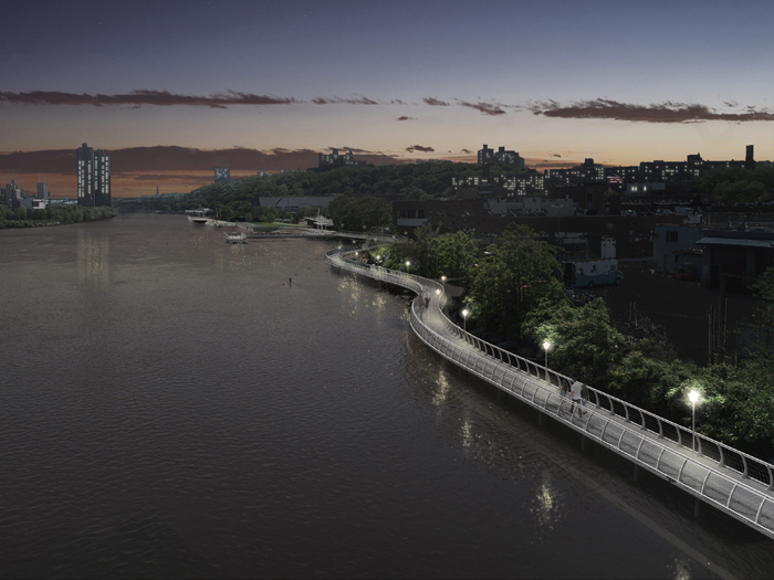
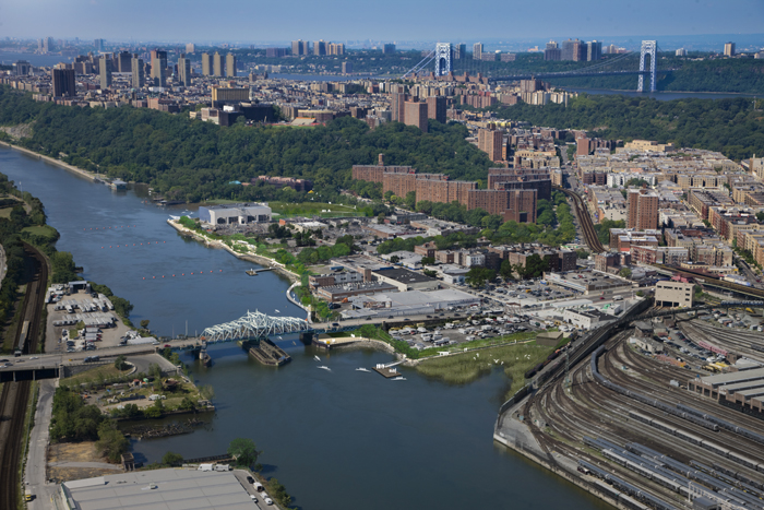
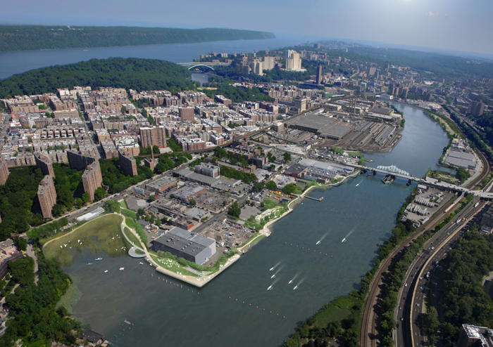
The Sherman Creek Waterfront stretches along the Harlem River between Sherman Creek Inlet near Dyckman Street to the existing tidal wetland at West 208th Street.
The project is a major civic opportunity for northern Manhattan and adjacent neighborhoods in the Bronx, focusing attention on the last undeveloped waterfront land left in Manhattan.
POSTED ON: 08.01.2011.
The Esplanade Site is relatively flat and spans the Upper Manhattan side of the Harlem River waterfront. The Esplanade Site’s boundaries are Sherman Creek Inlet to the south, an existing tidal wetland at the end of West 208th Street (the North Cove) to the north, the Harlem River to the east, and the lots immediately adjoining the riverfront to the west.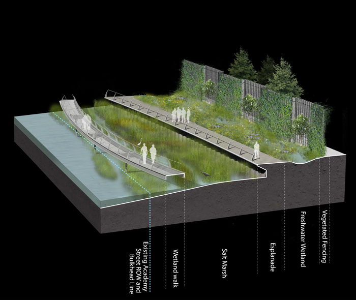
POSTED ON: 08.01.2011
The right of way for Academy Street in this section will be transformed into a nature park with restored salt marshes, freshwater wetlands for stormwater management, public lawns, shade structures, and a wetland walk extending The Malecón out over the water, bridging over the salt marshes with walkways and broad look-out areas.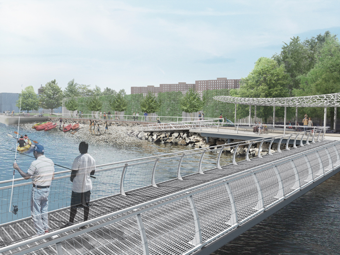
POSTED ON: 08.01.2011.
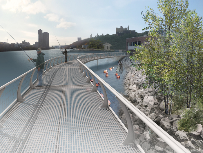
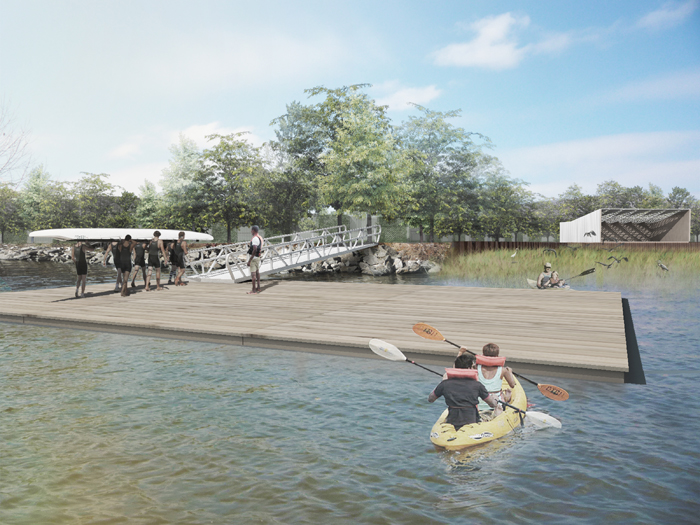
Pebble Beach Park extends from West 202nd Street to West 204th Street, the largest amenity area along the eastern edge of the Esplanade Site. Here visitors will be able to engage directly with the River by kayaking or relaxing on pebble beach. A new fishing pier will extend out at the end of West 204th Street, which has been identified as the main urban axis connecting to Broadway to the west. This section of the Esplanade also incorporates a fitness area, half basketball court, and a play area for kids with shading and water features.